
Infrastructure • Thermal + RGB • Surveying and Progress Monitoring
Infrastructure Thermography and Construction Progress Monitoring
We support operators and contractors with thermographic infrastructure inspections (for example, pipelines and utility networks) and recurring construction progress monitoring. We provide data in a format that supports comparison over time: orthomosaics, IR/RGB data, measurements, profiles and 3D models — ready for decision-making, technical acceptance and reporting.
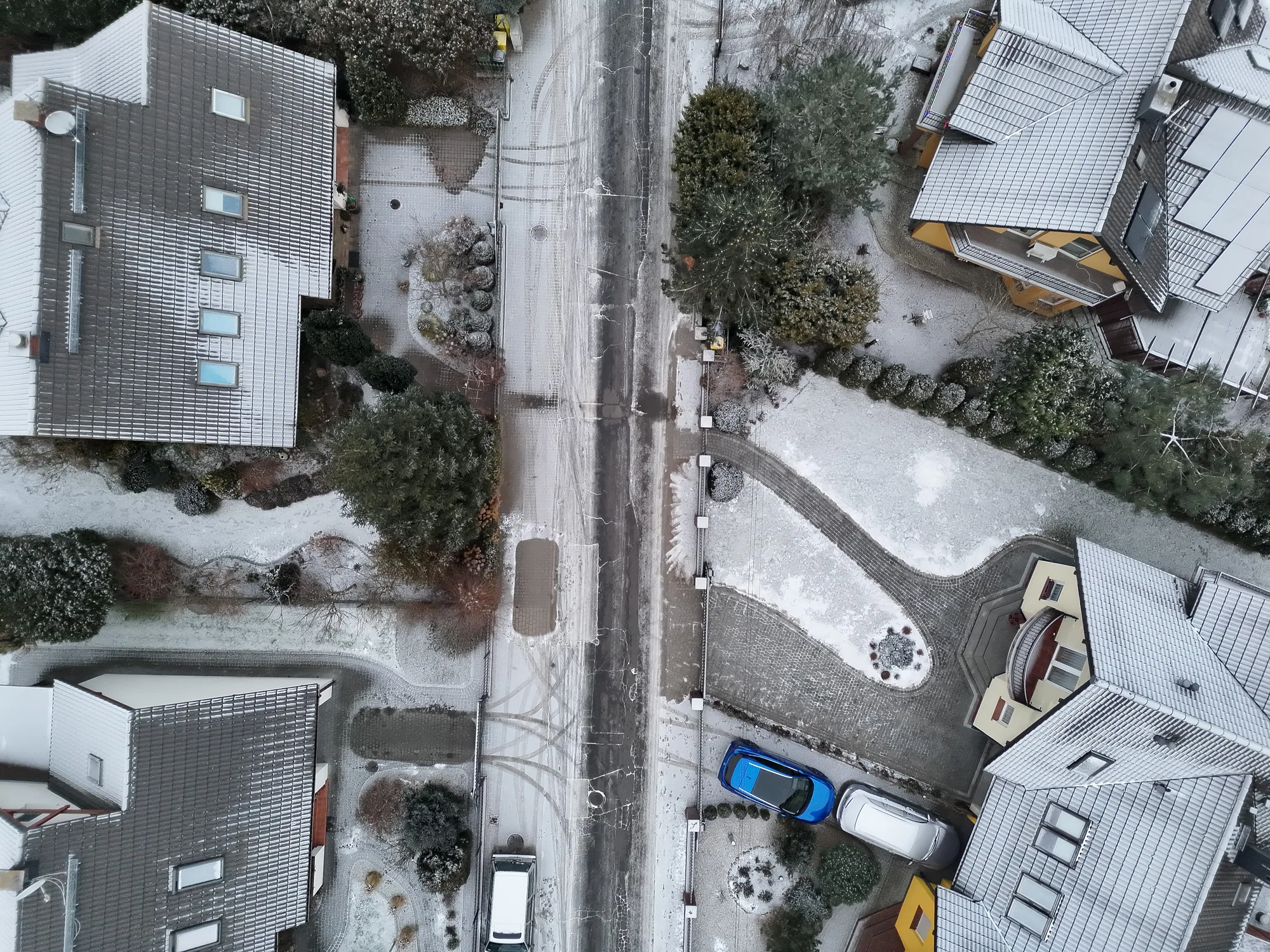
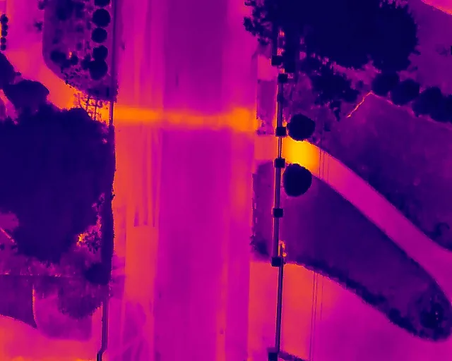 RGBThermography
Key Benefits
Tailored to the Needs of Operators, Contractors and Site Supervision
Rapid Anomaly Identification
Detection of temperature variations, heat loss and areas requiring on-site verification
Repeatable Time-Based Comparisons
Scheduled UAV surveys and a consistent data format for progress monitoring and change documentation
Decision-Ready Data
Orthomosaics, 3D models, measurements and CAD comparisons
What We Deliver
Depending on the Project: IR / RGB / 3D / Surveying
Results and Deliverables
- RGB orthomosaics and thermal (IR) orthomosaics for the survey area or corridor.
- Identification of thermal anomalies (e.g. heat loss) with corresponding RGB context.
- 3D models and point clouds for volumetric analysis, geometry and condition documentation.
- Core measurements: distances, cross-sections, profiles and time-based comparisons.
- Optional: Comparison CAD vs As-Built (overlay) for compliance verification.
Data Format: tailored to the tools you use (maps, reports and GIS) and the project requirements.
Typical Applications
- Networks / Pipelines: detection of heat loss and anomalies along infrastructure corridors.
- Construction Sites: progress monitoring and as-built documentation (scheduled UAV surveys).
- Earthworks Inspection: measurements, cross-sections, footprint verification and slope analysis.
- Project Handover / Site Supervision: comparisons and structured documentation.
We present the results in a format that is clear for site managers, supervising engineers and clients.
Send the site location (address, area or KML) together with a brief description of the objective: infrastructure thermography, progress monitoring, measurements or CAD comparison. We'll prepare a proposed delivery approach.
Send Enquiry
+48 571 007 231
Example Results
Examples of Available Output Formats
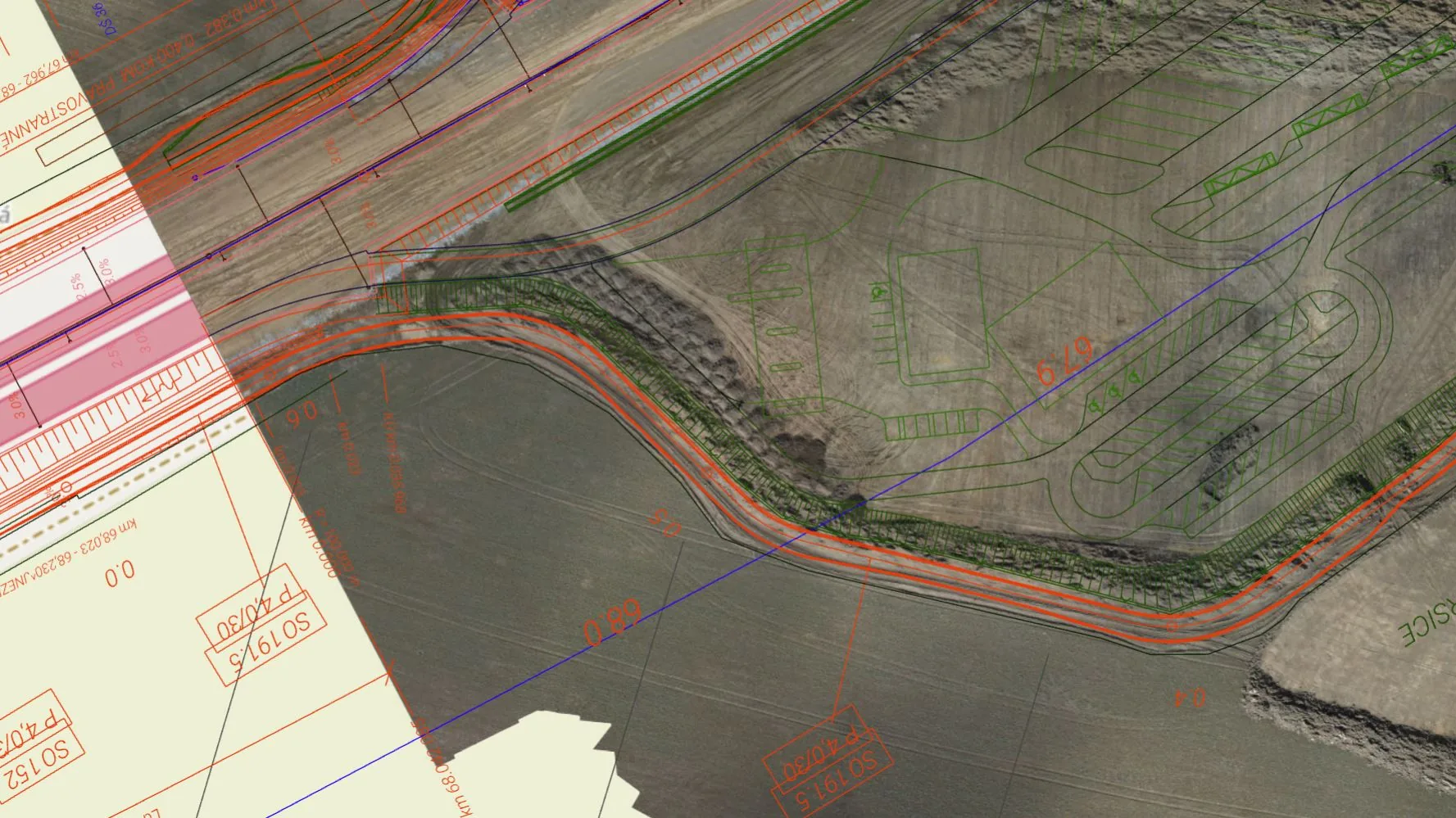
CAD vs As-Built — Rapid Verification of Compliance and Deviations
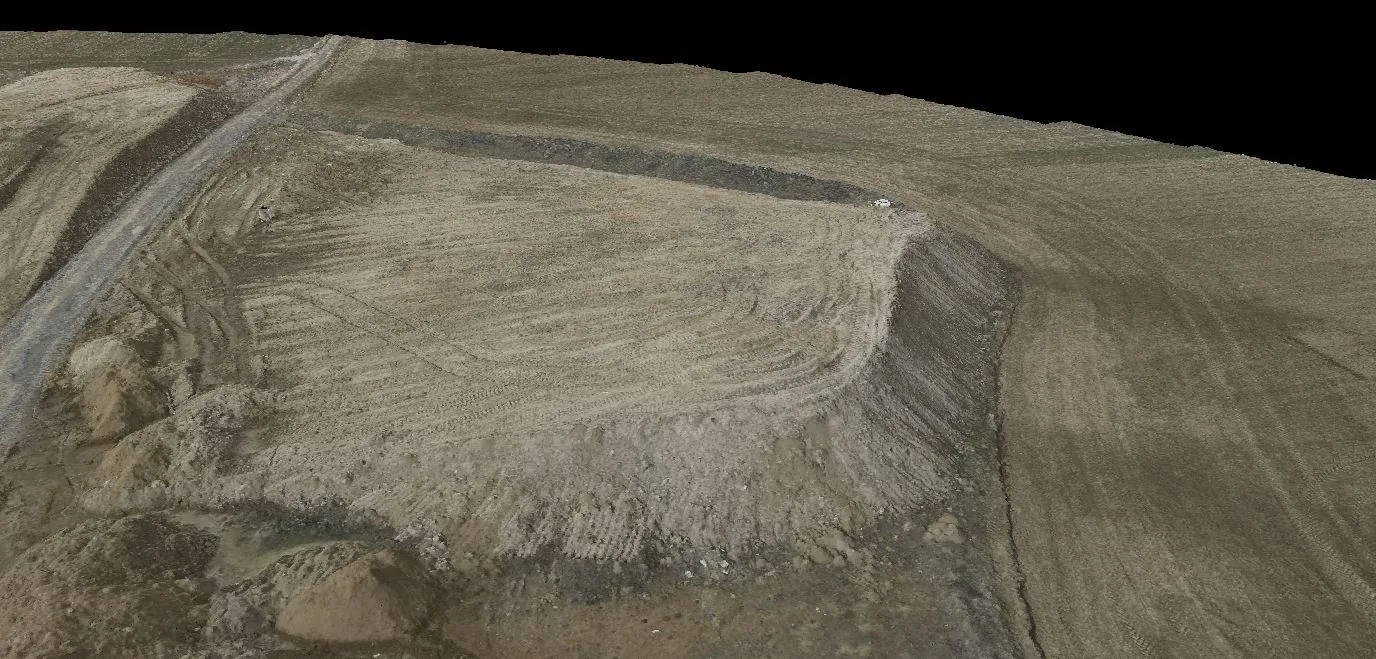
3D Model / Point Cloud — Basis for Condition Assessment and Documentation
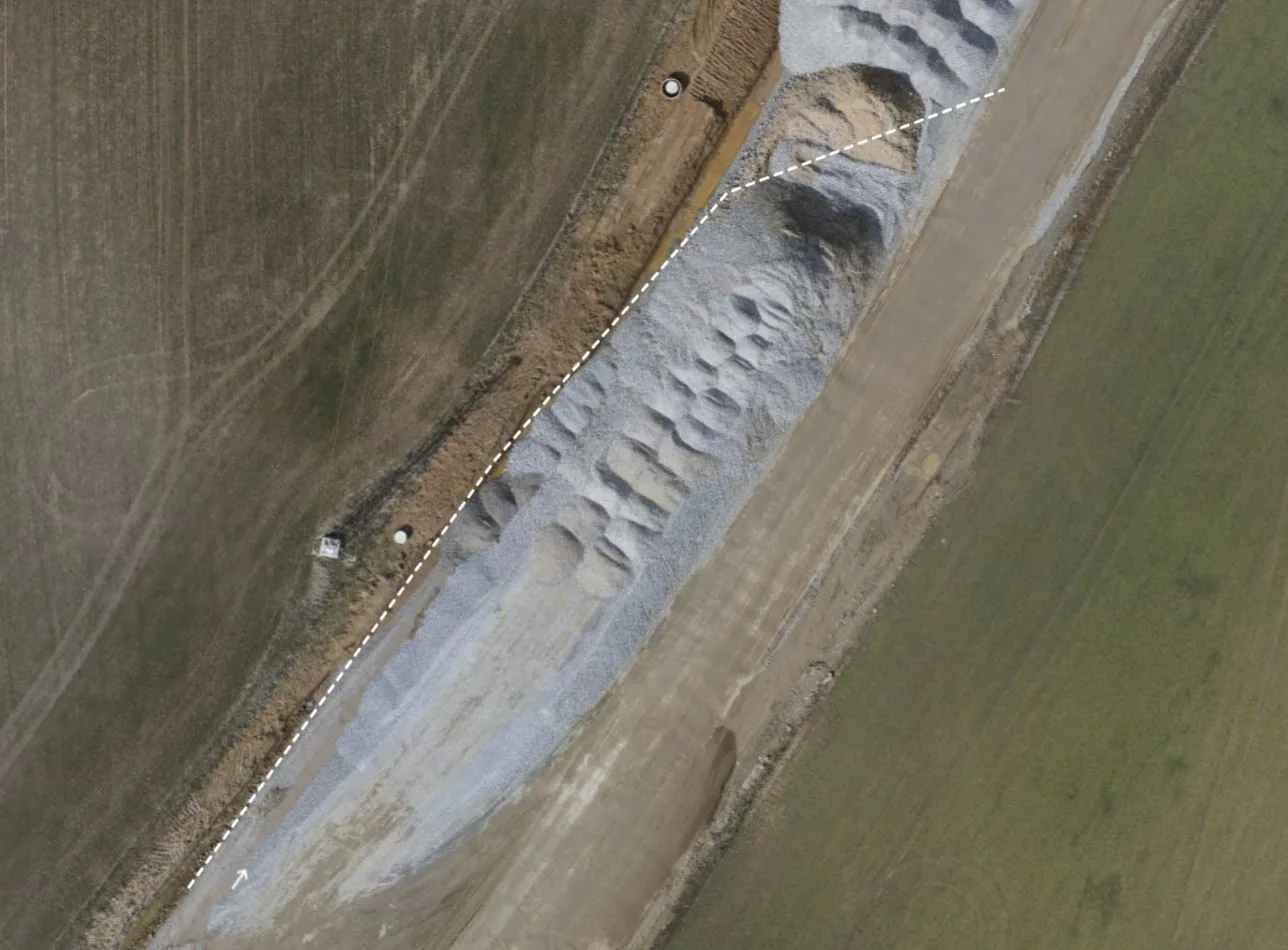
Measurements and Profiles — Rapid Distance Measurements, Cross-Sections and Earthworks Inspection
Data is structured to simplify condition comparison, stakeholder communication and long-term archiving.